Thank you for your participation!
Town Council adopted the River District Small Area Plan on July 19, 2023. Throughout the process the Town has hosted various community outreach efforts, and received input via stakeholder interviews with residents, developers, and environmental groups, and a Visual Preference Survey. A public comment period began in May and concluded with the Public Hearing in June. Thank you to everyone who participated in our events and provided feedback and comments on the plan!
Plan overview & highlights

The Neuse River is an incredible natural asset, and it offers a distinct opportunity to create a community destination and establish a sense of place that is unique in Knightdale. The River District Small Area Plan creates a clear vision for the district and provides guidelines and policy statements for future private development related to permitted land uses, architecture, infrastructure, and cohesive signage and branding. The plan also helps the Town identify opportunities for future public projects, such as improving walkability and connectivity by filling in greenway and sidewalk gaps. Possible re-development opportunities and park/open space needs are also explored. The plan also:
- Created four new guiding principles to be used in addition to those in the KnightdaleNext 2035 Comprehensive Plan
- Emphasizes creating a walkable, connected community that provides ample destinations and recreational activities
- Revised the Town's Growth & Conservation Map to expand several mixed use centers, introduce a neighborhood node, and create a new Trail-Oriented Development place type
- Includes low impact development standards and green infrastructure for future development
- Recommends expanding the town's greenway network and filling in sidewalk gaps to improve connectivity
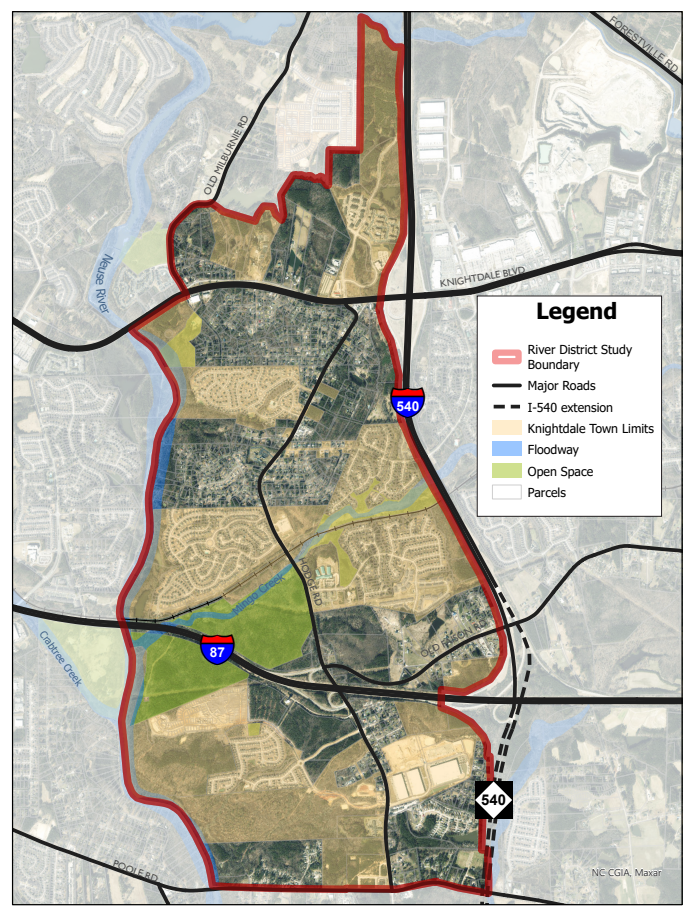
District location
The River District covers approximately 4 square miles along Knightdale's western jurisdictional boundary. It stretches from Legacy Oaks to the north, down to Poole Road to the south, and is bounded by the Neuse River and Interstate 540 on either side. (Click on the map to enlarge)
planning process timeline
The process kicked off at the end of 2022 and the first few months focused on public outreach, including stakeholder interviews, pop-up events, and a visual preference survey. A draft plan was released in May for public comment and an open house was held in early June. On July 10, 2023 the Land Use Review Board recommended adoption of the plan, and on July 19, 2023 the Town Council adopted the River District Small Area Plan.
